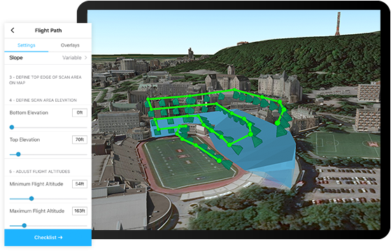
Site Scan for ArcGIS
A drone management system that collects mapping images and spins them together

- Category Analytics Software
- Languages Japanese, Portuguese, Spanish


A drone management system that collects mapping images and spins them together

Create 2D drawings and 3D models based off of virtually anything in reality