
CARTO
Generates more effective routes for transportation and finds ideal locations for businesses based on foot traffic

- Category Analytics Software
- Languages English
An innovative location-based data visualization tool for improved business intelligence.
Overview
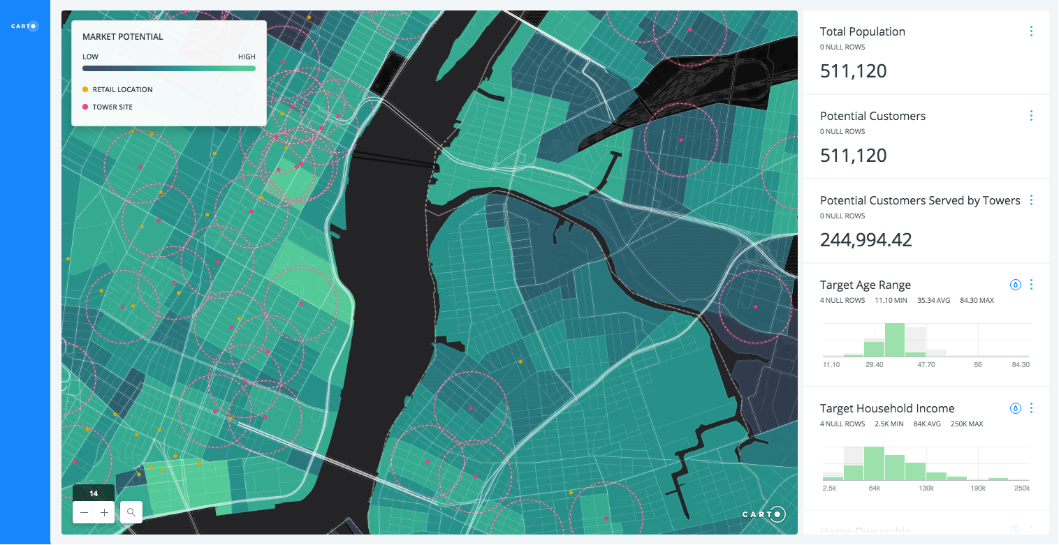
CARTO is an advanced data visualization tool that specializes in location-based intelligence. It's designed to help businesses make data-driven decisions by offering insights into geographical patterns and trends. This tool is appreciated for its ability to gather, analyze, and visualize spatial data effectively.
Features and Functionality
When it comes to features, CARTO stands out in the domain of data visualization tools. It provides an intuitive dashboard that allows users to easily manage and analyze datasets. With its robust geospatial data analysis capabilities, users can process and visualize complex spatial data, enabling them to extract meaningful insights from raw data.
CARTO supports a wide range of data formats, including CSV, Excel, and Shapefile, providing flexibility for businesses with various data needs. Users can also seamlessly integrate the platform with other data sources like Google Drive and Dropbox for efficient data management.
Usability
Despite its sophisticated capabilities, CARTO maintains a user-friendly interface that doesn't require extensive technical expertise. It offers a drag-and-drop feature, simplifying the process of data visualization for both novice and advanced users. Additionally, it provides numerous customizable templates to streamline the process of creating detailed and insightful maps.
Performance
CARTO's performance in handling large datasets is commendable. It efficiently processes and presents data without significant lags, ensuring a smooth user experience. Users can easily navigate through the platform and the data visualization process with minimal technical glitches.
Customer Support
CARTO is backed by a responsive and knowledgeable customer support team, ready to assist users with their queries. The platform also offers a comprehensive knowledge base and detailed tutorials to help users understand its features and make the most of the tool.
Conclusion
In conclusion, CARTO is a powerful tool for businesses seeking to leverage location-based data for decision making. With its versatile features, user-friendly interface, and reliable performance, it proves to be an invaluable asset for any data-driven organization.
Highest-Rated Features:
- Overlaying
- Data Visualization
- Performance and Reliability
Lowest-Rated Features:
- WYSIWYG report design
- Predictive Analysis
- Mobile User Support


- Company
- CartoDB
- HQ Location
- New York, NY
- Year Founded
- 2012
- LinkedIn® Page
- https://www.linkedin.com/company/5084329 (157 employees)